Research in the Forest
of Mikrokleisoura, Grevena

Mapping, monitoring and analysis of forest health using the DJI Mavic 3M drone and multispectral sensors, as part of the European project RAISE-Suite.

What We Are Researching

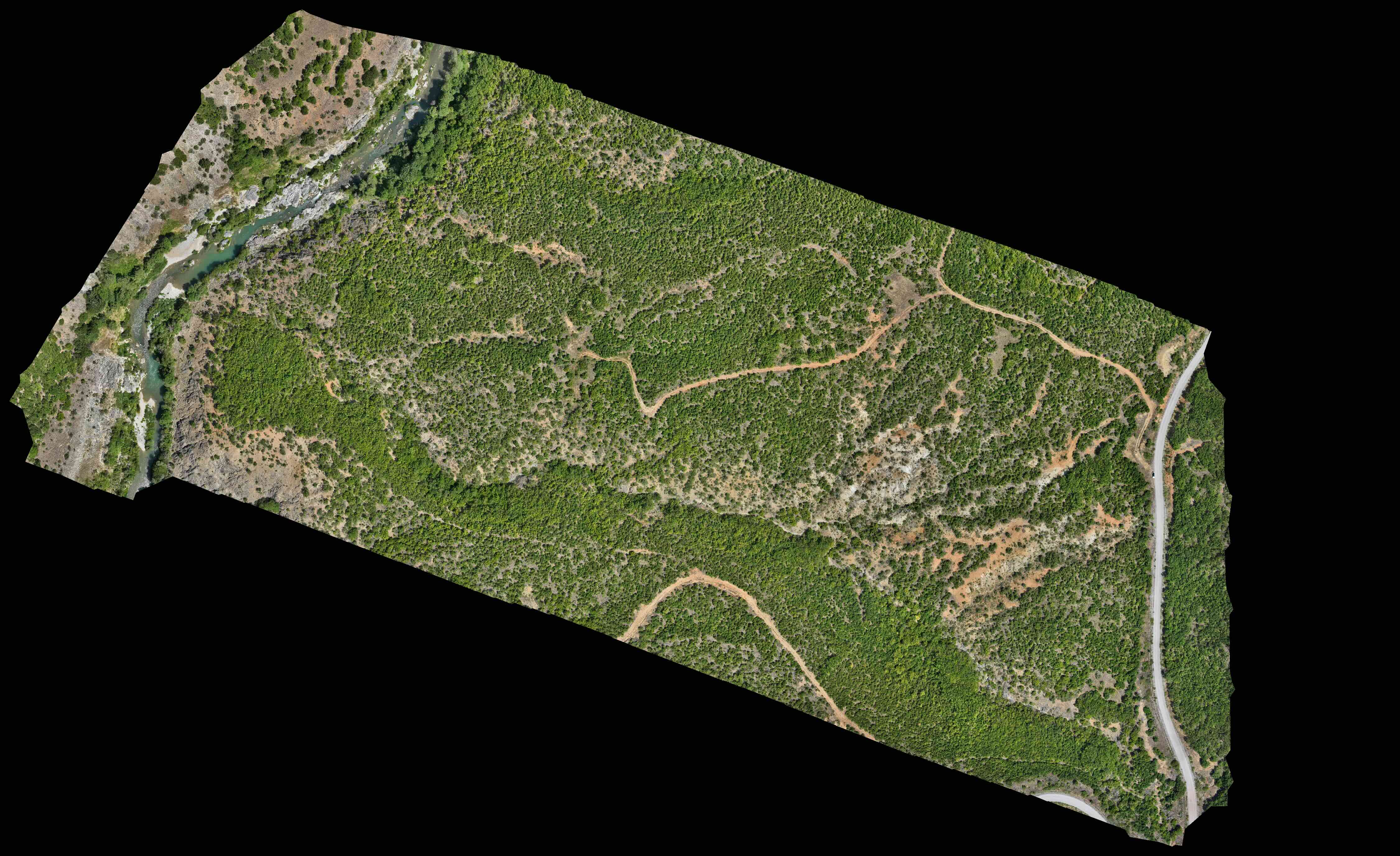
The Mikrokleisoura forest in Grevena is the site of a pioneering forest health monitoring programme, carried out within the framework of the Horizon Europe project RAISE-Suite. The goal is the systematic mapping and analysis of vegetation using modern drone and multispectral imaging technologies, providing the Cooperative with scientific data on the condition, health and evolution of the forest for the very first time.

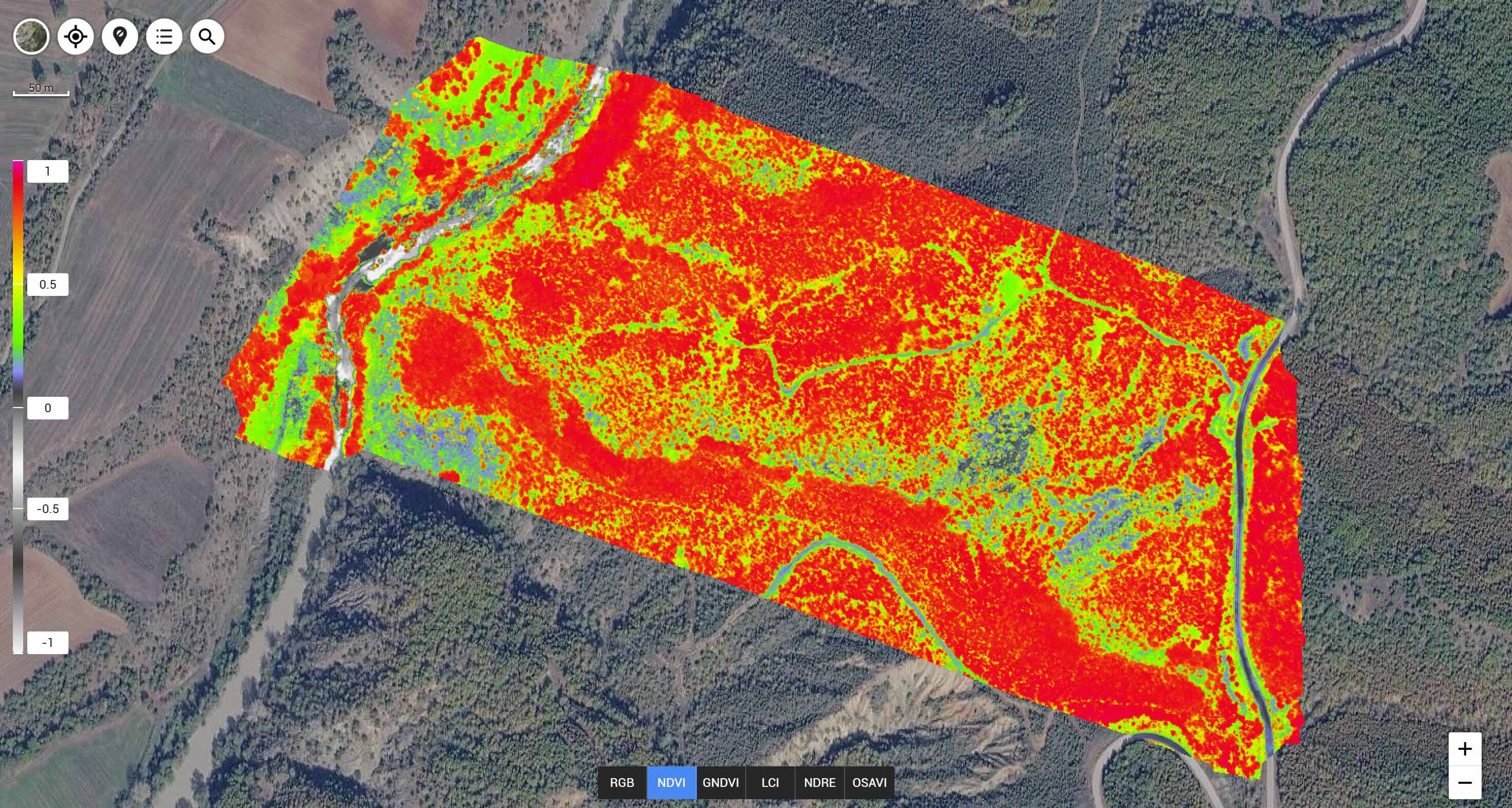
The data to be collected includes multispectral imagery (Green, Red, Red Edge, NIR) in addition to RGB, from which indices such as NDVI (Normalized Difference Vegetation Index) are calculated. This index enables the detection of damage, stress or disease in vegetation even before it becomes visible to the naked eye.
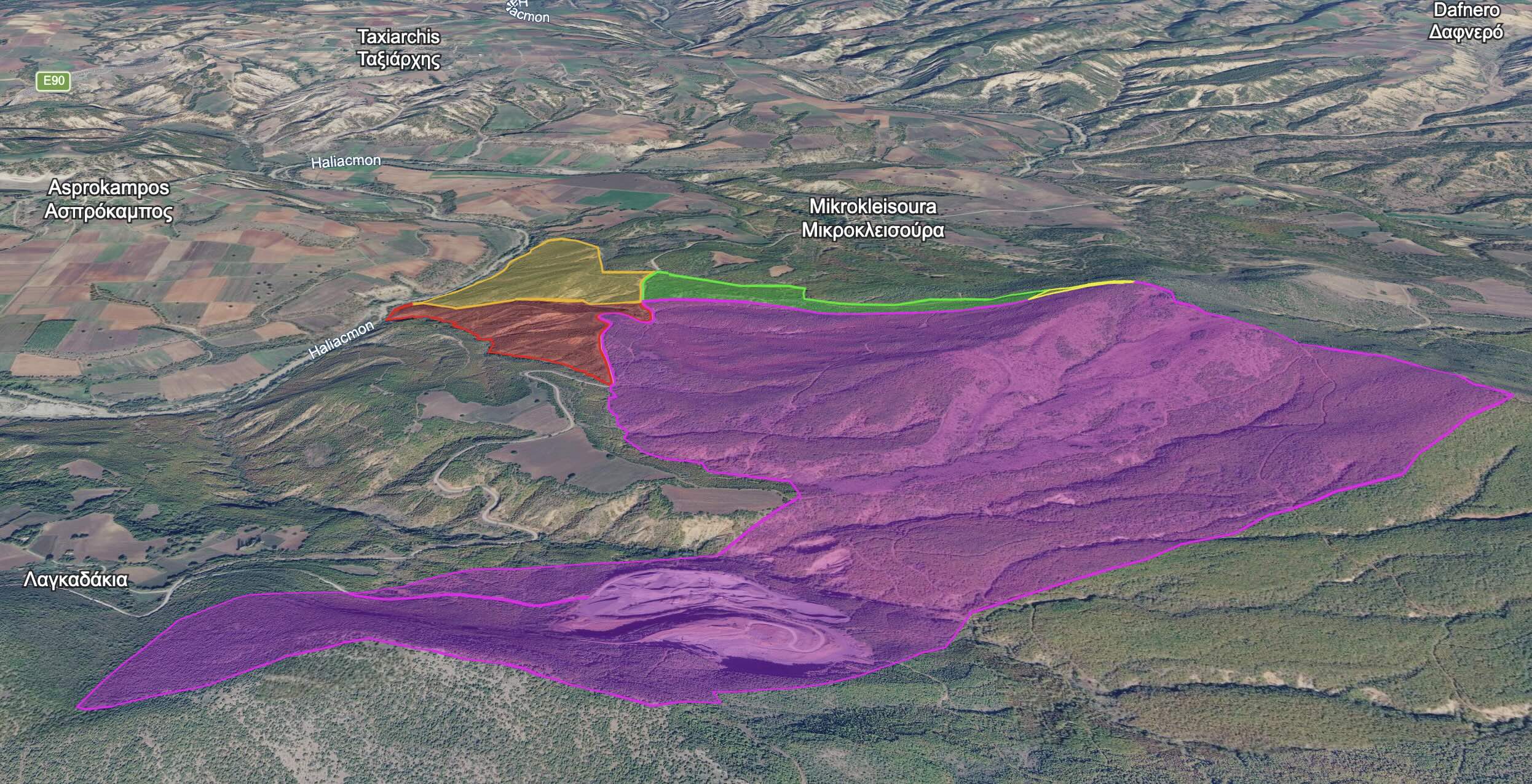
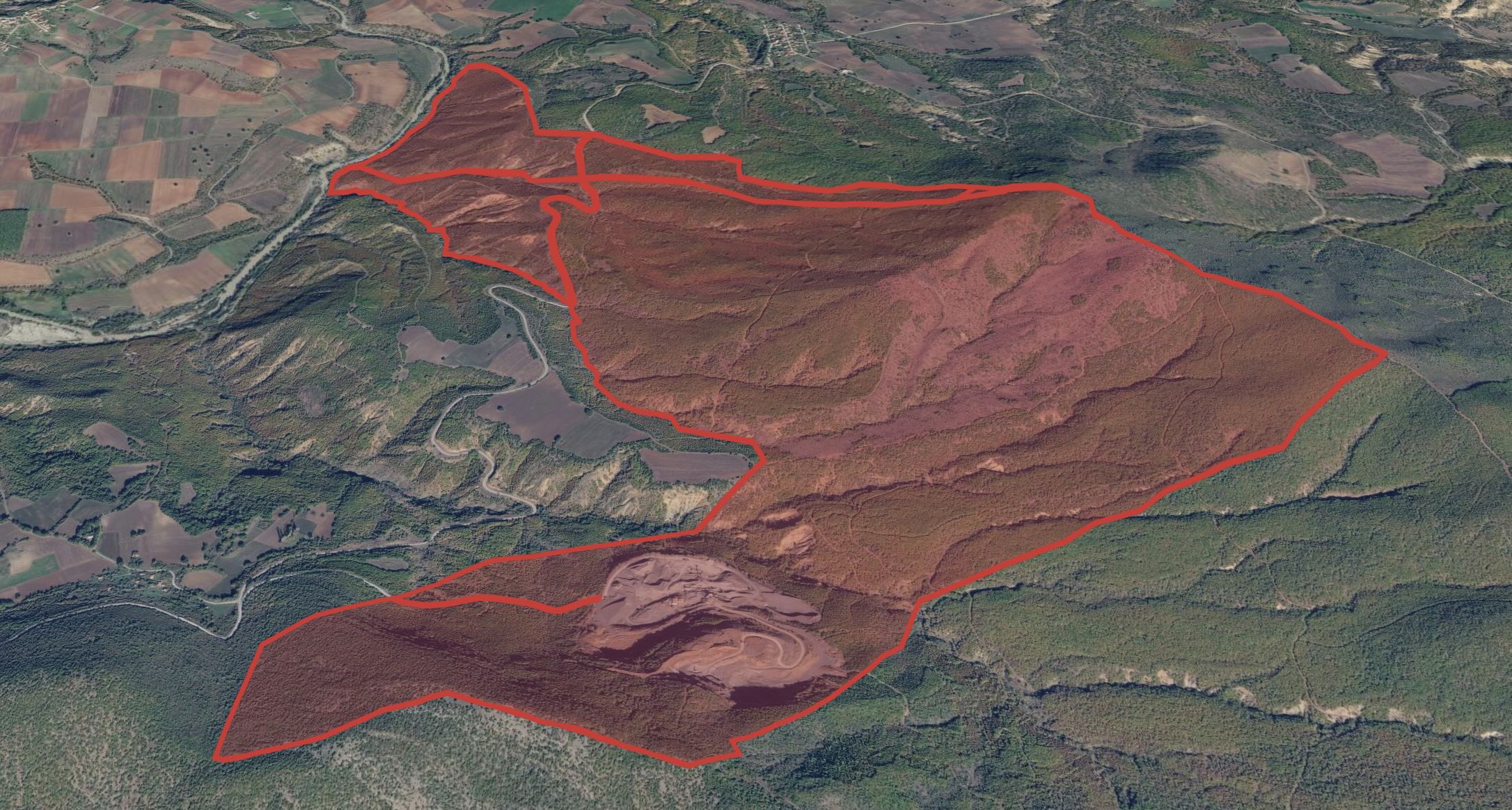
Forest map (3D visualisation)

DJI Mavic 3M: Why This Drone?

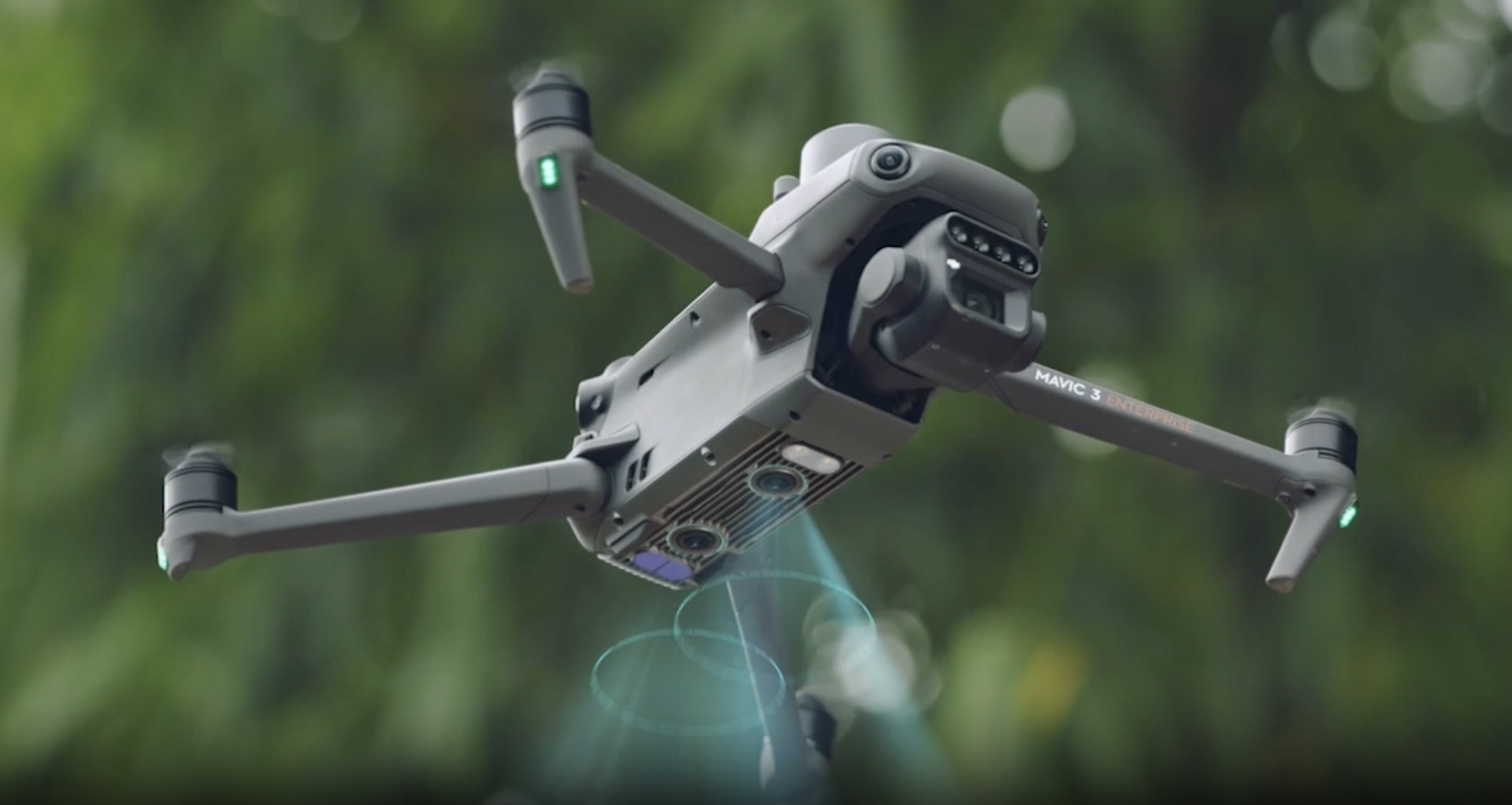
The DJI Mavic 3M is the professional reference drone for agricultural and forestry applications. It was chosen for the Mikrokleisoura research thanks to a series of critical advantages that make it ideal for this specific forest landscape.

Multispectral sensors

4 independent 5MP sensors: Green 560nm, Red 650nm, Red Edge 730nm, NIR 840nm plus a 20MP RGB camera. Each flight produces 5 data layers simultaneously, enabling full vegetation analysis.

Forest health detection

Thanks to near-infrared (NIR) capture, the Mavic 3M detects stress, disease or drought in vegetation before it becomes visible to the human eye โ€” a critical tool for timely intervention in forest management.

Performance in mountain terrain

Withstands winds up to 12 m/s (Beaufort 6) and operates reliably at the 470โ€“850m elevations of Vourinos, where the terrain is rugged and difficult to access by any other means.

Endurance & coverage

~43 minutes of flight per battery, with autonomous grid mission flight enabling coverage of hundreds of stremma per day with centimetre-level positional accuracy.

Sunshine sensor & calibration

The built-in sunshine sensor automatically balances measurements according to current lighting conditions, ensuring comparable data even across different days or times of flight. Essential for monitoring time-series.

DJI Mavic 3M photograph

Noosware & RAISE-Suite

Noosware

Noosware is a technology company based in Eindhoven, the Netherlands, specialising in the development of Artificial Intelligence solutions designed for the real world. It handles every phase of a project, from needs analysis through to development and production. It combines technical expertise with human-centred design and delivers projects in the fields of healthcare, agriculture, forestry and logistics.

RAISE-Suite

RAISE-Suite is a European research project with a mission to move from "open data for download" to "data open for processing", through a FAIR-by-design infrastructure for the full research data lifecycle. It applies this infrastructure to five real-world Use Cases; one of them is the Forestry (Soil Mission): monitoring of forested areas in Greece with multispectral imaging drones, in support of decisions related to ecosystem protection and reforestation.

Research in Progress: Field Diary

01
May 2026
Site Visit & Getting to Know the Forest

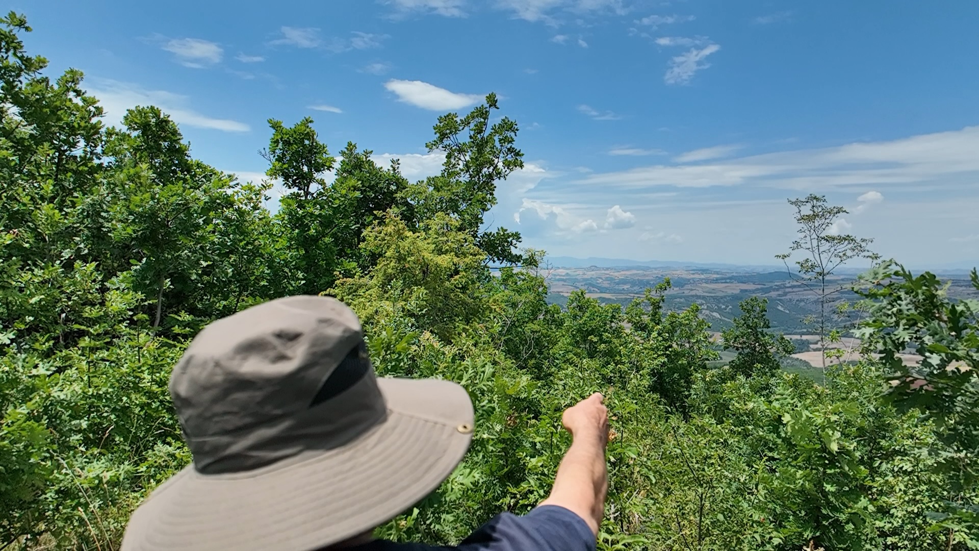
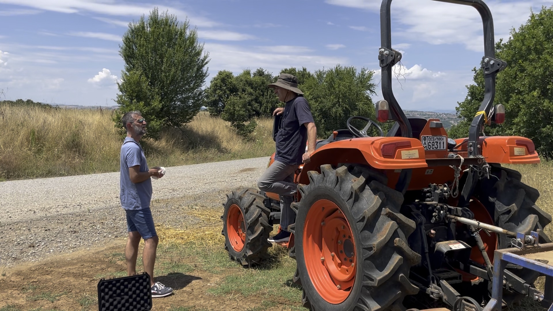
Researchers from Noosware visited Mikrokleisoura and were guided through the forest by members of the Cooperative. The tour was conducted by tractor along rugged tracks, revealing both the scale and the ecological richness of the forest at 570+ metres elevation.

The visit was essential for understanding the landscape, canopy density, terrain gradient, accessibility and the natural boundaries of the area.

"An amazing experience" โ€” the words that stayed with the team after the visit. Surrounded by dense oak forest, the scale and ecological value of the area were immediately apparent.
Noosware & Cooperative team in the forest
Tour by tractor along forest tracks
02
June 2026
Mapping the Forest Estate Boundaries

Using data from the Hellenic Cadastre and satellite imagery, the team accurately mapped the boundaries of the forest estate in a digital map (KML). The natural boundaries โ€” the Aliakmonas river to the north, the slopes of Vourinos to the south โ€” formed the basis for defining the research area and planning the flight missions.

Digital map of forest estate boundaries (KML / satellite view)
03
July 2026
Test Flights & Calibration

Test flights were carried out over the forest canopy to evaluate and calibrate the drone's settings: flight altitude, image overlap, speed, camera angle and exposure parameters for the multispectral sensors.

The first multispectral data produced an NDVI orthophoto map of the area, where intense red indicates high photosynthetic activity in the vegetation. Forest roads and paths are also visible (blue-green), as is the riparian zone of the Aliakmonas. This phase confirmed that the system is functioning correctly and the data is suitable for further analysis.

DJI Mavic 3M flight over the forest canopy
First multispectral data โ€” NDVI preview
04
August 2026
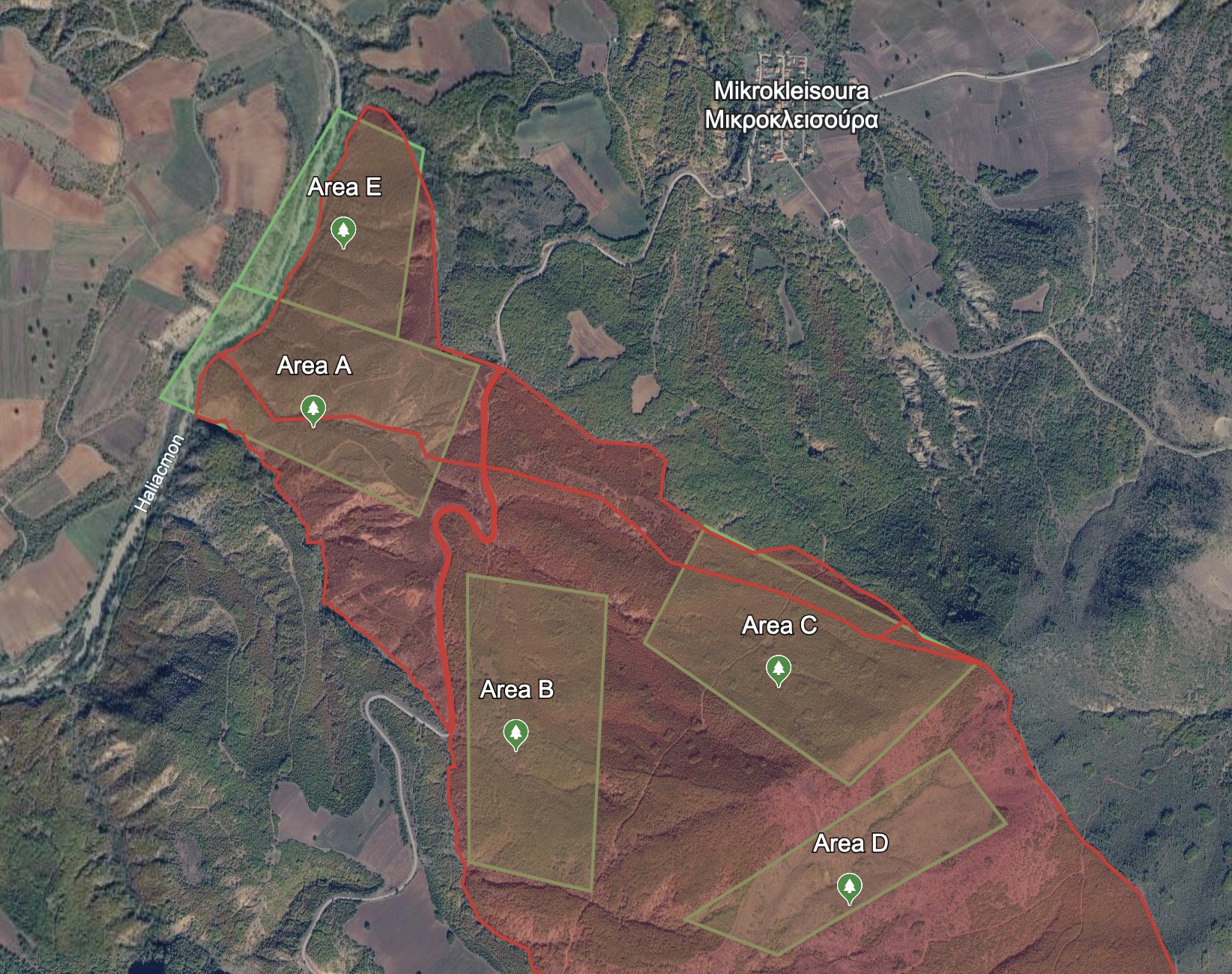
Defining 5 Research Zones (~1,200 stremma)

5 priority zones were mapped out for systematic surveying, covering approximately 1,200 stremma out of the total 3,950. The zones were selected based on accessibility, vegetation diversity and relevance to the Cooperative's interests.

Full autonomous grid mission flights with the DJI Mavic 3M will be carried out in each zone to collect a complete multispectral dataset.

5 research zones marked on the forest estate

What Comes Next

The research is ongoing. The next phases will extend coverage and produce the first comprehensive results for the Cooperative.

Full Flights

Systematic grid mission flights across all 5 zones to collect a complete multispectral dataset under ideal lighting conditions.

Processing & Analysis

Photogrammetry, creation of orthophoto maps and calculation of NDVI and NDRE indices across the entire surveyed area.

Results for the Cooperative

Delivery of a report and interactive maps to the Cooperative, providing an overview of the health and distribution of the forest vegetation.